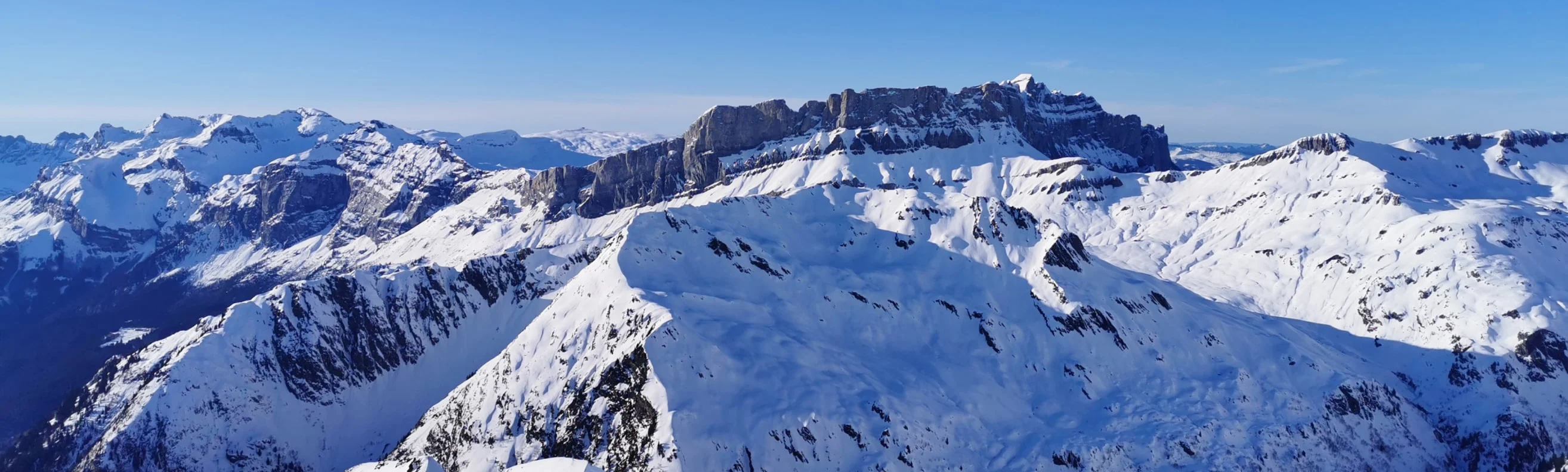
La Plagne is part of the larger Paradiski area, which also includes the neighbouring ski resorts of Les Arcs and Piesey-Vallandry, creating a total of over 425 km (264 mi) of ski runs. Plan your perfect ski holiday in advance: download the latest La Plagne piste map to familiarize yourself with the trails and lifts ahead of time.
La Plagne ski resort piste map
Plan your ski holiday ahead with our detailed piste map. Download it here, or pick up a copy at ticket offices and information points throughout La Plagne.

La Plagne piste map downloads
Click on the links below to download the latest La Plagne piste map
- La Plagne piste map pdf
- La Plagne piste map jpg
La Plagne best ski pistes
La Plagne combines expansive glacier terrain with wooded descents and hidden valley runs:
- Mont de la Guerre (Intermediate - Red): A long, scenic descent into Champagny-en-Vanoise, known for its changing terrain and dramatic alpine views.
- Bozelet (Intermediate - Red): A curving piste through quiet surroundings, perfect for smooth carving turns.
- Roche de Mio to Champagny (Intermediate - Red): This route links glacier slopes with tree-lined runs for a dynamic ski experience.
- Bellecôte (Expert - Black): A high-altitude run with steep pitches, suited for advanced skiers with a taste for adrenaline.
- Dérochoir (Expert - Black): A steep, thrilling slope dropping directly off the glacier’s edge.
- La Pollux (Intermediate - Red): Offers wide-open skiing ideal for confidence building at altitude.
- Le Rochu (Expert - Black): A demanding descent with exposed sections, best for technical experts.
- Arnica (Intermediate - Red): Smooth and flowing piste with great snow retention.
- Morbleu (Beginner - Blue): A welcoming piste that gently rolls through scenic terrain near Belle Plagne.
- Coqs (Intermediate - Red): A lively run with varying terrain, great for linking up different sectors.
- Palsembleu (Beginner - Blue): Meandering, gentle terrain through the forest, perfect for a relaxing cruise.
La Plagne in brief
- Resort elevation: 1,250 m (4,101 ft)
- Highest elevation: 3,250 m (10,663 ft)
- Vertical drop: 2,000 m (6,562 ft)
- Skiable terrain: 225 km (140 mi)
- Number of pistes: 137
- Type of pistes: 7% green, 57% blue, 24% red, 12% black
- Number of ski lifts: 76
- Longest run: 6 km (3.7 mi)
- Cross-country skiing: 80 km (49.7 mi)
- Snow-making: 35 km (21.7 mi)
View all our resorts in France
Val Thorens - La Plagne - Chamonix - Tignes - Avoriaz - Val d'Isère - Méribel - Les Arcs - Les Menuires - Courchevel - Flaine - La Clusaz - Serre Chevalier - Samoëns - La Rosière - Montgenèvre - Val Cenis - Megève - St Martin de Belleville - Les Contamines Montjoie - Les Saisies - Isola 2000 - Risoul - Les Houches - Valmorel - Les Carroz - Les Orres - Les Gets - Morzine - Les Deux Alpes - Alpe d'Huez - Vaujany - Les Sybelles - Sainte Foy Tarentaise - Saint Gervais les bains - Châtel