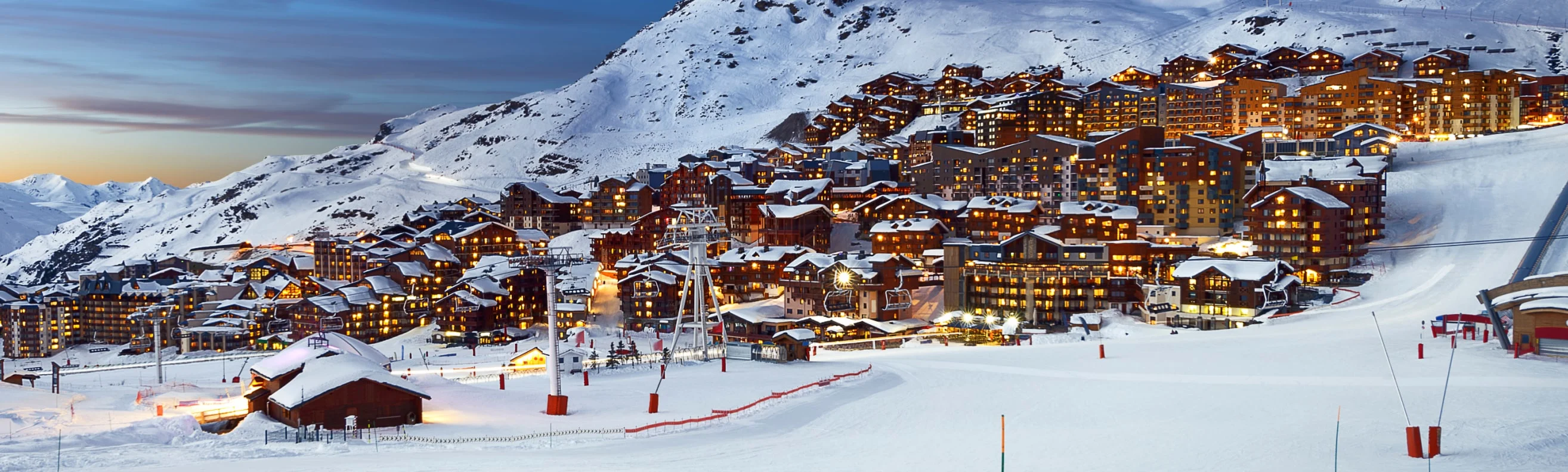
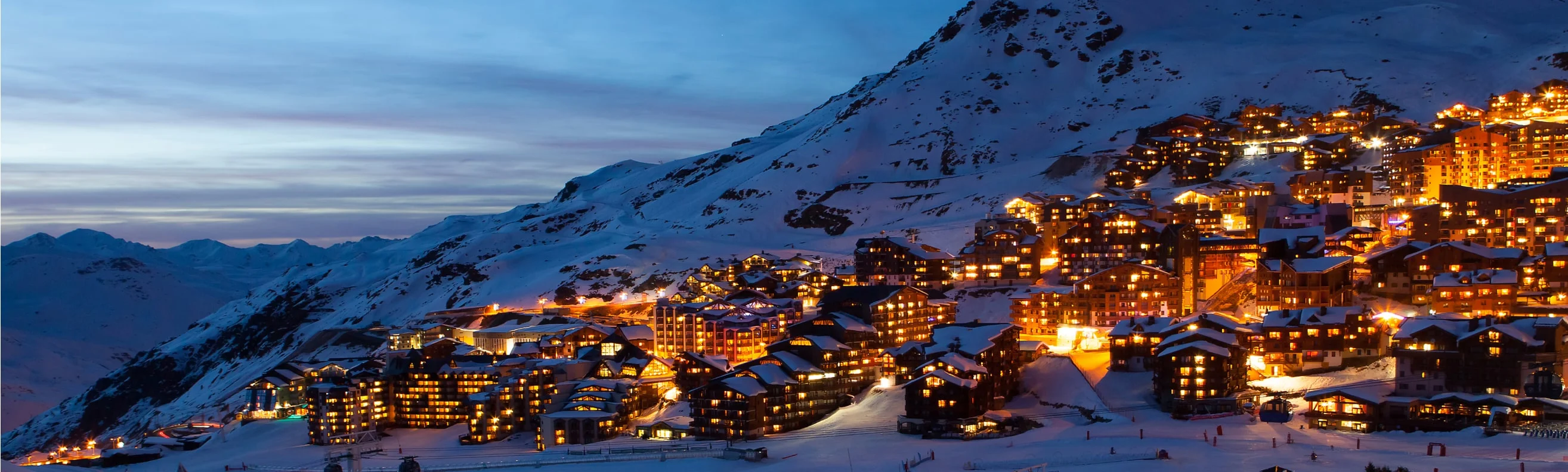
Perched at an altitude of 2,300 m (7,545 ft), Val Thorens offers diverse skiing experiences suitable for all levels, from gentle, wide beginner slopes to thrilling off-piste challenges. As you prepare for your visit to this premier ski destination, be sure to download the latest Val Thorens piste map. This guide provides a comprehensive overview of the vast network of pistes, detailing ski lifts, trail difficulties, and connections to the neighbouring resort of Orelle. It also highlights key amenities including restaurants, ski schools, and medical services, ensuring you can navigate the resort smoothly and confidently.
Val Thorens-Orelle piste ski map
Download the piste map here below, or pick up a copy at ticket offices and information points throughout the resort.

Val Thorens-Orelle piste map downloads
Click on the links below to download the latest Val Thorens-Orelle piste map
- Val Thorens-Orelle piste ski map pdf
- Val Thorens_Orelle piste ski map jpg
Val Thorens best ski pistes
Val Thorens stands out with its high-altitude skiing and excellent pistes:
- Tête Ronde (Intermediate - Red): A consistent fall-line and wide turns make this a popular piste for carving enthusiasts.
- Christine (Intermediate - Red): Known for its smooth gradient and excellent grooming, great for confident intermediates.
- Allamande (Intermediate - Red): A scenic run with playful terrain and well-sheltered snow.
- Jerusalem (Intermediate - Red): One of the area’s most beloved runs, winding gently with incredible mountain backdrops.
- Combe de Caron (Expert - Black): A long and challenging piste descending from the top of the Cime Caron lift, steep and exhilarating.
- Combe de Rosaël (Expert - Black): Features steeper pitches and often fantastic snow conditions; great for strong skiers.
- Col de l'Audzin (Intermediate - Blue): A fun cruiser piste, well-suited to building confidence.
- Plein Sud (Intermediate - Blue): Wide and sunny slope with high skier traffic but reliably good conditions.
- Masse (Intermediate - Red): A fast piste with a consistent gradient, ideal for strong intermediates.
- Lac Noir (Intermediate - Red): Technical and less crowded, offering a great escape from busier runs.
- Dame Blanche (Expert - Black): A steep, leg burning descent that rewards strong technical ability.
- Rocher Noir (Expert - Black): Challenging run with off-piste options and excellent snow in colder weather.
Val Thorens in brief
- Resort elevation: 2,300 m (7,546 ft)
- Highest elevation: 3,230 m (10,597 ft)
- Vertical drop: 930 m (3,051 ft)
- Number of pistes: 83
- Type of pistes: 11 green, 37 blue, 28 red, 7 black
- Longest run: 3.5 km (2.2 mi)
- Skiable terrain: 150 km (93.2 mi)
- Number of ski lifts: 30
- Snow making: 48 ha (119 acres)
- Snowpark: 1
- Family park: 1
View all our resorts in France
Val Thorens - La Plagne - Chamonix - Tignes - Avoriaz - Val d'Isère - Méribel - Les Arcs - Les Menuires - Courchevel - Flaine - La Clusaz - Serre Chevalier - Samoëns - La Rosière - Montgenèvre - Val Cenis - Megève - St Martin de Belleville - Les Contamines Montjoie - Les Saisies - Isola 2000 - Risoul - Les Houches - Valmorel - Les Carroz - Les Orres - Les Gets - Morzine - Les Deux Alpes - Alpe d'Huez - Vaujany - Les Sybelles - Sainte Foy Tarentaise - Saint Gervais les bains - Châtel